

En esta noticia
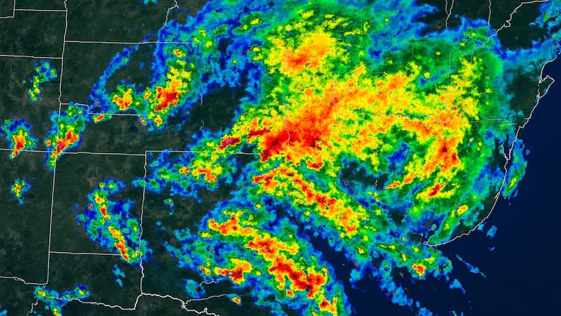
An extended stretch of rough weather is settling over the New York City area, as forecasters track a developing coastal storm expected to bring gusty winds, dangerous surf and repeated rounds of coastal flooding through the week and into the weekend.
According to the National Weather Service’s Wednesday morning forecast discussion issued by the Upton, NY office, forecast models generally agree that a coastal low will track southeast of the region between Friday and Saturday, though it remains uncertain exactly how close the storm’s center will come, and whether it will linger nearby or drift closer through Sunday. The latest model guidance keeps the storm just close enough for its effects to be felt across the area.

Coastal flooding builds through the week
Even before the storm’s core arrives, persistent northeast winds between high pressure to the north and the developing low to the south are expected to trap water along the coast, worsening tidal flooding. The NWS already issued a Coastal Flood Statement for southern Nassau County for Wednesday’s afternoon and evening high tide cycle, with brief minor flooding possible at the most vulnerable waterfront spots, including areas along the Great South Bay and southwest Suffolk County.
From there, forecasters expect the combination of northeast winds, rising astronomical tides tied to Saturday’s full moon, and building seas to produce multiple rounds of minor to locally moderate coastal flooding, dangerous rip currents, and beach erosion, with the worst effects likely Friday and Saturday. Just how severe the flooding gets will depend on the storm’s exact track and intensity, with wind direction playing a key role.
High risk of rip currents and rough surf
A high risk of rip currents remains in effect along all local ocean beaches through Wednesday evening, driven by increasing easterly swells of 8 to 10 feet and strengthening northeast winds above 20 knots.
That elevated risk is expected to persist into the weekend as ocean swells and winds continue building ahead of the storm, with surf heights potentially topping 6 feet by Thursday.
Gusty winds through the week
Winds will stay breezy through midweek even before the storm’s core nears the coast. Wednesday winds are expected to increase to 15 to 20 knots with gusts of 25 to 30 knots in the afternoon, with isolated gusts near 35 knots possible during the morning and early afternoon.
As the storm approaches Friday and Saturday, winds could strengthen further, with gusts potentially reaching 25 to 35 knots Friday and 30 to 40 knots Saturday, highest along the coast and east of the city — and possibly up to 10 knots higher if the storm tracks closer to shore. A Small Craft Advisory and Gale Warning are already in effect for offshore waters.

Timeline and how bad it could get
This week is shaping up as a slow buildup rather than a single fast-moving storm. Tuesday through Thursday is expected to bring mild temperatures and windy conditions to the area, with the storm strengthening as it tracks north toward the Tri-State area by Saturday and Sunday.
How severe conditions get in New York City ultimately depends on the storm’s final path. A track that brings the low closer to shore as a stronger system could put the city directly in the path of heavy rain, strong wind gusts, and major storm surge.
A track that keeps the low farther out to sea would leave the city on the outskirts of the storm, with breezy conditions and some rain, but sparing it from the worst flooding.