En esta noticia
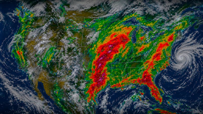
An intense thunderstorm system is expected to arrive in the eastern United States. Experts warn of the possibility of destructive wind gusts, tornadoes, large hail, and flash flooding, especially in rural areas and areas with poor drainage systems.
In this scenario, severe weather alerts were issued in several sectors of the region. The phenomenon will last at least until Friday and will move across different states, widening the risk of dangerous weather conditions over the next few days.
The storm of the century: What will its path be and when will it impact each state?
According to the experts at AccuWeather, the storm system will reach its peak intensity between Wednesday and Thursday as it moves from the Great Plains toward the Midwestern United States.
Starting Wednesday, the front will begin to move eastward and affect Minnesota, Wisconsin, Iowa, northern Illinois, eastern Kansas, and part of Michigan. Among the main cities under alert are Minneapolis, Chicago, Milwaukee, Kansas City, and Des Moines.
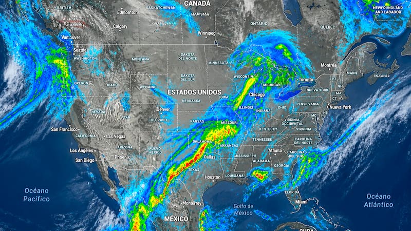
By Thursday, the threat will extend to the rest of Michigan, Illinois, and Kansas, as well as states such as Missouri, Indiana, and Oklahoma. The cities that were already at risk will remain under watch, while Detroit, Indianapolis, St. Louis, Tulsa, and Wichita will be added.
By Friday, the risk of intense tornadoes will decrease, although the storms will remain dangerous. Torrential rains and damaging winds are expected to move toward the Ohio Valley, the Great Lakes region, and parts of the Appalachians, where new severe weather alerts could be issued.
48 straight hours of heavy rain, wind gusts of 75 mph, and hail are expected
During Wednesday afternoon and night, wind gusts of between 65 and 85 mph (105 to 137 km/h) are expected, with the potential to cause damage to trees, power lines, and vulnerable structures.
The most severe conditions will arrive on Thursday, when gusts could reach 70 to 95 mph (113 to 153 km/h). Meteorologists consider this to be the most intense day of the event, due to the combination of destructive winds, severe thunderstorms, large hail, and the risk of tornadoes.
By Friday afternoon, the system will begin to gradually weaken. Although storms and rainfall will continue to be recorded, wind gusts will decrease to values between 50 and 70 mph (80 to 113 km/h), reducing the potential for more destructive extreme phenomena.