
En esta noticia
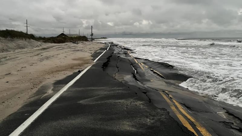
A new coastal storm hit North Carolina, in the United States, and caused flooding, beach erosion, and damage to a major road in the Outer Banks. As a result, authorities had to close again a stretch of NC-12 highway, which had been repaired after another storm in September.
According to AccuWeather, the North Carolina Department of Transportation (NCDOT) confirmed that approximately 244 meters of pavement were damaged near the Pea Island Visitor Center.
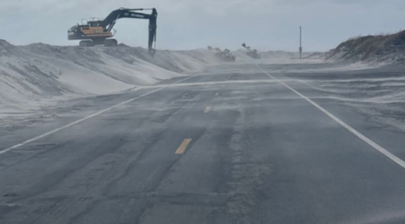
In addition, the strong waves caused the loss of about 549 meters of protective dunes, which worsened the road conditions and complicated efforts to restore traffic.
Which highway remains closed in North Carolina because of the storm?
NC-12 highway remains closed between the Marc Basnight Bridge and Rodanthe, a key stretch for connecting Hatteras Island with the northern Outer Banks.
The closure began on Monday, October 19, around 6 p.m., after the surf overtopped the protective dunes and flooded the road near Pea Island.
According to the latest AccuWeather update, damage to the pavement and the loss of natural barriers make reopening the affected stretch difficult. Authorities have not yet announced a date to restore traffic.
This is the second time in about a month that a storm has severely affected the same highway. In September, another storm damaged nearly 305 meters of the NC-12 and forced emergency repairs.
How long will flooding continue in North Carolina?
According to the Dare County, the National Weather Service (NWS) warned that high tides could cause coastal flooding through Thursday, October 22.
Although the sky may remain clear in some areas, the storm continues to generate dangerous conditions along the coast.
The main risks include strong waves, beach erosion, and water advancing over sections of the highway.
Forecasts indicate that winds and surf would begin to ease during Thursday, with a gradual improvement toward the end of the week. However, flooding could continue even after the winds lose intensity.

What restrictions apply to those traveling to Hatteras Island?
Authorities are keeping the state of emergency in Hatteras Island and entry restrictions for visitors in effect.
The mandatory evacuation order applies to visitors to the island, but not to residents or to areas located north of Oregon Inlet.
Dare County said tourist entry will be allowed again once the storm has passed and NC-12 highway is no longer threatened by the advance of the water.
Meanwhile, authorities recommended avoiding the closed stretch and checking the official updates before traveling.