
En esta noticia
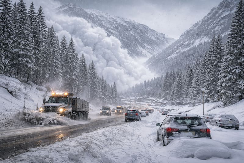
The National Weather Service issued an alert for a winter storm in the middle of the last week of June, with up to 30 centimeters of snow in much of the affected area and even greater accumulations on the highest peaks. The warning hits the mountain passes that lead to several national parks.
The warning applies to areas above 1,980 meters in height and lasts until Monday. The system is due to a low-pressure system that moved in after a cold front and caused temperatures to plunge from one day to the next, in the middle of summer.
Which areas are under alert for the winter storm?
The warning covers the east and west of Lemhi County, in Idaho, along with the Bitterroot, Sapphire, and Butte/Blackfoot areas in Montana, all above 1,980 meters. Added to this are winter advisories in neighboring mountain ranges such as Gallatin, Madison, and the Beartooth Highway.
Snow accumulations vary according to elevation. The National Weather Service details the following ranges for the next few hours:
- 10 to 20 centimeters of wet snow above 1,980 meters across much of the warning area.
- Up to 30 centimeters on the highest peaks.
- Between 20 and 40 centimeters in the high mountains of the Butte/Blackfoot region.
- Wind gusts of up to 48 km/h, reducing visibility at crossings.
How does this alert affect travel and what should drivers do?
The greatest risk is on high-elevation roads that feed access to Yellowstone, Grand Teton, and Glacier. Passes such as Lost Trail Pass, Targhee Pass, and Monida Pass on Interstate 15 fall within the snow band, with risk of refreezing overnight and frost at daybreak.
Authorities recommend postponing mountain trips while the system clears. For those who must cross, the basic precautions are:
- Bring chains, a blanket, flashlight, portable charger, water, food, and a full tank.
- Triple the braking distance compared with dry pavement.
- Avoid passes at night, when ice is more likely.
- Check Idaho 511 and the Montana traffic map before leaving.