
En esta noticia
A new storm system with heavy rain threatens major cities in the eastern United States this weekend. The corridor connecting Washington D.C., Philadelphia and New York is among the areas at greatest risk of heavy rainfall and flash flooding.
The conditions arrive after several severe weather episodes that left abundant water accumulation in parts of the Mid-Atlantic and the Northeast. The combination of wet soils and new storms capable of dumping large amounts of rain in a short time could cause waterlogging in streets, roads, and urban areas over the next few hours.

The storm of the century is arriving in New York, New Jersey, Philadelphia
From Saturday, August 22, the chance of rain and storms returns from parts of the Mid-Atlantic to the Northeast. AccuWeather warns especially about the Interstate 95 corridor, where cities such as Washington D.C., Baltimore, Philadelphia, and New York are located. Some storms may move slowly and dump nearly 2 inches of rain in about one hour, enough to generate flash flooding in vulnerable areas.
The danger is greater due to the rainfall accumulated during the previous days. In some areas of Pennsylvania, New Jersey, New York, and Connecticut significant amounts of rain were recorded, so new storms can quickly cause problems in streets, roads, streams, and urban drainage systems.
The outlook will begin to improve during Sunday, August 23. In Washington D.C., for example, the National Weather Service (NWS) anticipates mostly sunny conditions and a high near 85 F (29 C), while Philadelphia would have around 83 F (28 C) and mostly sunny skies after the chance of rain on Saturday night.
Forecast for next week: will storms and heavy rain continue?
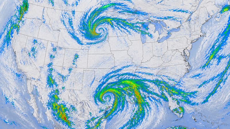
The improvement on Sunday does not necessarily mean the end of unsettled weather. A new system will move from the Plains toward the eastern United States and may bring another round of strong storms during the start of next week, with heavy rain, wind gusts, and a chance of hail in different areas.
AccuWeather notes that a pronounced bend in the jet stream will move east and once again favor the development of storms. The system will arrive after a weekend in which some areas of the Northeast will already have received abundant rainfall, so it will be important to monitor the evolution of flood risk.

At the same time, cooler air will move in behind these systems, allowing temperatures to drop across much of the interior Northeast and the Great Lakes region.