
En esta noticia
The National Aeronautics and Space Administration (NASA) revealed the images captured by the Curiosity rover that show what sunrise on Mars is like.
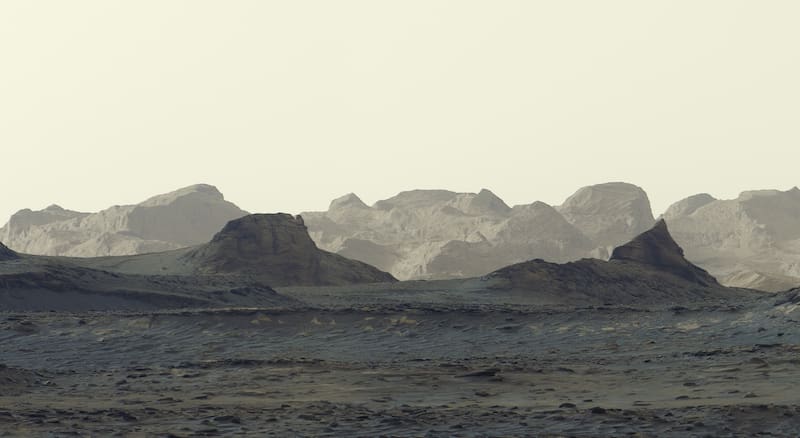
Six individual images were taken that were joined together to form a panoramic view after being sent to Earth. According to NASA, these were processed without the white balance that is usually added in order to preserve the appearance of the sunrise, resulting in a little-seen postcard that looks like it came from a movie.
What was sunrise like on Mars, according to NASA’s photos?
The photographs were taken on August 11, 2026 at 8:30 in the morning during Martian day number 4,982 and were finally published by the federal agency on October 6.
The images captured by Curiosity’s Mastcam camera show bluish tones in the foreground and rocky formations illuminated by the morning light.
Among the photographed structures are the yardangs, rock formations shaped by wind erosion. They extend for approximately 16 kilometers through the northwestern region of Mount Sharp, a mountain five kilometers high.
Scientists are still investigating how these structures originated. One hypothesis is that part of the material that composes them comes from ash deposited during ancient volcanic eruptions.
What you need to know about the Curiosity rover
Curiosity is a NASA robotic exploration vehicle that arrived on Mars in August 2012 and began investigating Gale Crater. Its main mission is to study the planet’s geology and climate to determine whether conditions were ever favorable for microbial life.
Since 2014, the rover has been climbing Mount Sharp, which has different layers of rock that preserve information about different periods of Martian history.
Among the main facts about its mission, the following stand out:
- Exploration site: Gale Crater, on Mars.
- Start of surface operations: August 2012.
- Scientific objective: to study the environment and determine whether Mars had suitable conditions to host microbial life.
- Instruments: cameras, chemical analysis systems, and tools to examine rocks and soil.
- Recent progress: it has surpassed one kilometer of total elevation gain since it began ascending Mount Sharp.