En esta noticia
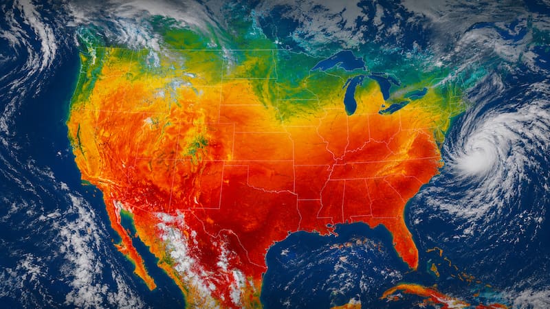
A new heat wave is arriving in the United States, and this time it comes accompanied by severe storms, heavy rains, hail, and strong wind gusts.
According to the weather forecasts, different storm systems will move across the center and east of the country before and during the expansion of this wave, increasing the likelihood of flash floods and other severe phenomena.

Alert for strong storms, heavy rains, and powerful wind gusts
According to experts from AccuWeather, two major storm systems moved from the Plains to the Great Lakes region and the Ohio Valley.
A more intense system is then expected to move through the Midwest before heading toward the Appalachians. Forecasts indicate that these storms may produce
- Wind gusts between 55 and 65 mph.
- Hail is capable of causing damage.
- Heavy rains.
- Risk of flash flooding.

More storms during the weekend
It is also explained that the favorable conditions for storm formation will persist in the central Plains over the weekend.
This is thanks to the combination of warm, humid air, which creates the right conditions for the development of new precipitation systems.
For today, Friday, the highest risk is located from western Texas and eastern New Mexico toward central and eastern Montana.
During Saturday and Sunday, the most concentrated storm activity will be over the northern Plains and parts of the Midwest.
What to expect for the week when June ends, and July begins
With the strengthening of this heat dome over the Midwest next week, new storms will move around the Rocky Mountains and the High Plains toward the northern Midwest and much of the northeastern United States.
The advice is to stay alert to weather updates in case there is any major update.