En esta noticia
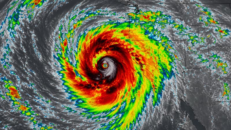
The United States National Weather Service (NWS) issued an alert for a strong storm system that could last for two consecutive days in different regions of the country. The phenomenon will be accompanied by heavy rain, severe storms, and wind gusts that could exceed 52 mph.
The Weather Prediction Center (WPC) warned that the system will move in with abundant moisture and atmospheric instability. This could cause flash flooding, frequent lightning activity, and significant amounts of water accumulation in just a few hours.
The NWS warns of severe storms and torrential rain
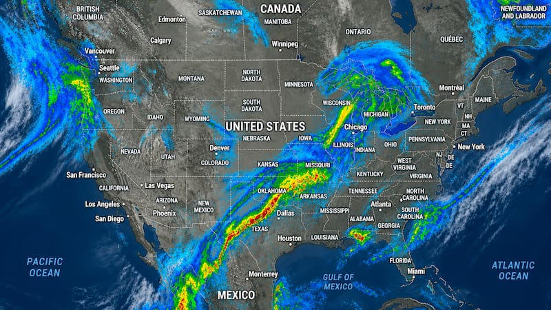
Meteorologists indicated that the heaviest rainfall will be concentrated in areas in the south and part of the east coast of the United States. Several areas are already under severe storm watch.
The most intense storms could generate destructive wind gusts, hail, and urban flooding. In addition, there is a risk of rapid stream rises and traffic problems on roads.
Which areas are at greatest risk from the storm
Forecasts place the highest chances of heavy rain in Texas and other states in the southern part of the country. Some cities could see persistent storms for 48 consecutive hours.
The WPC explained that the main concern will be the rapid accumulation of water in urban areas. For this reason, they recommended following official alerts and avoiding driving through flooded streets.

The flood of the century could bring flooding and power outages
The system will also be accompanied by strong wind gusts that could exceed 52 mph in isolated areas. This increases the likelihood of falling trees and temporary power outages.
Specialists pointed out that the most severe conditions would develop over the next few hours and could remain active through the weekend.