En esta noticia
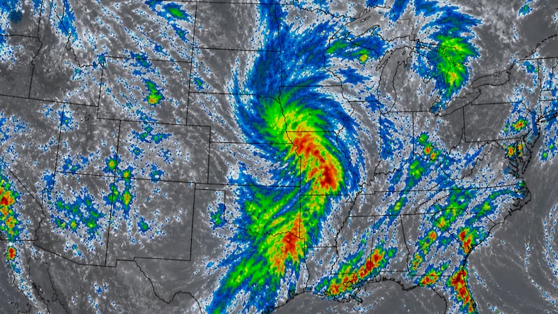
A new episode of severe storms will arrive in much of the United States during Memorial Day weekend, bringing torrential rain, thunderstorms, and wind gusts of up to 85 mph that could cause flooding and damage.
Meteorologists indicated that the unstable pattern will remain active for at least 72 consecutive hours over large areas of the central and southern parts of the country, affecting travel and outdoor activities.

The areas under alert for the deluge: what the experts say
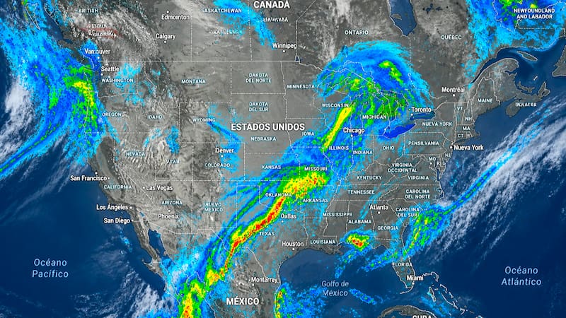
According to specialists at AccuWeather, the greatest flood risk will be concentrated in eastern Texas and the Mississippi Valley, where storms could repeat over the same regions for several consecutive days.
As large accumulations of water are expected, alerts were issued for areas such as
- Houston
- Beaumont
- Orange
- Port Arthur
- the area known as the Golden Triangle in Texas
All the areas that will see strong storms during the weekend
The system will also affect large areas of:
- Texas
- Oklahoma
- Louisiana
- Mississippi
- Alabama
- Georgia
- the Carolinas
- the Ohio Valley
Alert for hail and dangerous winds
After the round of storms that affected the Midwest and the Northeast days ago, the severe weather timeline is now distributed as follows
Friday, storms will develop in
- western Texas
- western Oklahoma
Weekend
- western and southern Texas
- Hill Country
- Brownsville
- Lubbock
- San Antonio
Hail, dangerous gusts, torrential rain, and even the possibility of isolated tornadoes are expected.
What to expect after the weekend
Weather projections indicate that the wet pattern will not change quickly and could continue through much of next week.