En esta noticia
A new severe weather scenario will affect various regions of the United States throughout this week and even during the Fourth of July weekend in the United States.
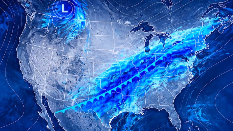
According to the experts’ forecast, storms will move along the edge of a large heat dome, which will result in several consecutive days of heavy rain, strong storms, and wind gusts around 55 mph in various areas of the country.
In addition to heavy rainfall, flash flooding, large hail, and lightning are also a concern.

Alert for intense storms today Wednesday: what the experts say
According to specialists at AccuWeather, today the risk of severe storms extends from
- West Texas
- Eastern New Mexico
- Up to northern Michigan
At the same time, storms are expected to extend to New York and Scranton in the northeastern part of the country.

Which areas are under alert for Thursday
On Thursday, the risk will shift and mainly affect
- Central Ontario
- Southern Quebec
- Northern New England
On the other hand, in the west the severe storms could reach from
- Eastern Montana
- The Dakotas
- Northern and eastern Nebraska
- Central and southern Minnesota
- Western Wisconsin
- Iowa
Where intense storms are expected this Friday
For Friday, the forecasts anticipate that strong storms will cover all the areas mentioned for Thursday, but they will also reach
- Much of Wisconsin
- Northern Missouri
- Northern Illinois
- Michigan
- Northwestern Indiana
In the south of the country there will also be intense storms with dangerous winds and heavy downpours, especially toward the west.

Forecast for the weekend in the United States
Specialists warn that with the weakening of the heat dome, the risk of storms increases for the north-central part of the country and for the northeast.
It will therefore be essential to stay alert to weather advisories when planning the celebrations.