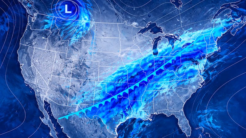

A new round of severe thunderstorms will arrive this weekend in different areas of the Midwest and the northeastern United States, with a risk of heavy rain, flooding, and dangerous wind gusts.
This pattern will arrive after several days of significant weather activity in the region. Some areas have already recorded torrential rain and flooding, so the flood risk will be greater in areas where storms pass repeatedly.
The areas at highest risk of storms and flooding
According to AccuWeather, for today, Friday, the flood risk is concentrated from Iowa to Indiana.
New rounds of storms are expected to move toward Missouri by the afternoon, with wind gusts and rain capable of causing flash flooding.
For Saturday, new rounds are expected from the Midwest to the Ohio Valley. Chicago is one of the areas that could receive strong storms, with wind and rain capable of causing flooding.
On Sunday, the risk shifts to Ohio, Pennsylvania, and West Virginia. These storms may generate gusts of 89-105 km/h, along with rain capable of causing flash flooding.
A weekend marked by repeated storms
The weather situation will be marked by several rounds of storms that will affect different parts of the Midwest and the Northeast.
The buildup of previous rainfall intensifies the risk of new flooding, and the main hazards will be torrential rain and damaging wind gusts.
As a result, outdoor activities and travel may be affected by this storm system.
The advice is to stay alert to weather updates at all times in case there is any important announcement that should be known.