
En esta noticia
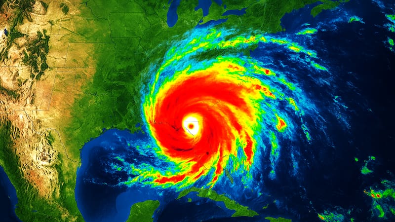
Hurricane Isaias is forecast to make landfall on the northern U.S. Gulf Coast late Friday or early Saturday. Based on the storm’s forecast track, Fox Weather estimates its impacts will be centered on roughly 30 million people in Louisiana, Mississippi, Alabama and the Florida Panhandle.
As of 7 a.m. CDT Thursday, the National Hurricane Center placed Isaias about 385 miles south-southwest of the mouth of the Mississippi River. The Category 1 storm had 80 mph winds and was moving east-northeast at 9 mph. It is expected to strengthen through early Friday.
Florida Gov. Ron DeSantis and Alabama Gov. Kay Ivey have declared states of emergency. Evacuation orders are in place on Dauphin Island, Alabama, and in parts of Okaloosa County, Florida.
When will Hurricane Isaias hit the US Gulf Coast?
Tropical storm conditions are expected to reach the warning areas Friday, according to the hurricane center. Hurricane conditions should follow Friday night into early Saturday, when Isaias is expected to come ashore within the hurricane warning zone.
Isaias is forecast to turn northeast later Thursday as it passes north of Mexico’s Yucatan Peninsula. It should then turn north Friday and remain a dangerous hurricane as it nears the coast that night.
The hurricane center says preparations in the warning area should be finished Thursday. Once tropical-storm-force winds arrive, outdoor work becomes difficult or dangerous.
Which Gulf Coast areas are in Hurricane Isaias’ path?
The hurricane center has posted alerts between southeastern Louisiana and Florida’s Big Bend. A warning means dangerous conditions are expected, while a watch means they are possible:
- Hurricane warning: Ocean Springs, Mississippi, to the Bay/Gulf County line in Florida.
- Storm surge warning: Mouth of the Mississippi River to the Steinhatchee River in Florida.
- Tropical storm warning: Jefferson/Plaquemines Parish line in Louisiana to west of Ocean Springs, and east of the Bay/Gulf County line to the Aucilla River in Florida.
- Storm surge watch: Steinhatchee River to Yankeetown, Florida.
Residents should follow evacuation instructions from local officials and check their local National Weather Service office for alerts specific to their area.
What storm surge, rain and tornado risks does Hurricane Isaias bring to the Gulf Coast?
The hurricane center calls the storm surge threat life-threatening. If the peak surge arrives at high tide, water could rise to these heights above normally dry ground:
- 5 to 7 feet: Ocean Springs, Mississippi, to Indian Pass, Florida, including Mobile Bay.
- 4 to 6 feet: Indian Pass to the Steinhatchee River.
- 3 to 5 feet: Mouth of the Mississippi River to Ocean Springs.
- 2 to 4 feet: Steinhatchee River to Yankeetown.
- 1 to 3 feet: Lake Pontchartrain.
From Friday through the weekend, far southeastern Louisiana to the Florida Panhandle could get 3 to 7 inches of rain, locally up to 10. Parts of the Southeast as far north as the Tennessee Valley and the Carolinas could see 1 to 3 inches, raising the risk of flash flooding.
Isolated tornadoes are possible Friday night in coastal Alabama, the Florida Panhandle and far southwestern Georgia. On Saturday, the threat shifts to eastern Alabama, Georgia and northern Florida. Life-threatening rip currents are also expected along Gulf beaches starting Friday.