
En esta noticia
Starting on Monday, August 10, 2026, this broad area of the country will face a run of rain and storms that will last for three days, with the most intense point on Tuesday and totals that could lead to flash flooding.
The August storm is coming
The state of Michigan, with the Detroit area and the Great Lakes region as the epicenter, will face a storm caused by a front moving across the north of the country and entering the Great Lakes region, loaded with moisture.
The NOAA Weather Prediction Center (WPC) anticipates moderate to heavy rain becoming increasingly likely across the Upper Midwest and the Great Lakes at the start of this week, with the focus shifting toward the upper Ohio Valley by Tuesday.
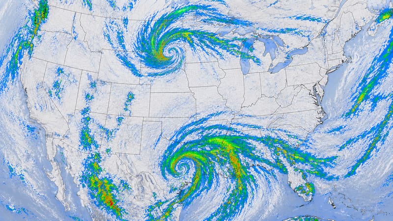
That scenario favors the development of back-to-back storms, with rain that can become intense within hours and create flooding problems in the most vulnerable areas.
Heavy rain and wind gusts for 72 straight hours
The episode is a succession of days with storms and a growing chance of rain. According to the forecast for the Detroit area, in the heart of the region:
- Monday, August 10: around a 45% chance of rain and storms, as conditions begin to become unstable. Highs near 29 C.
- Tuesday, August 11: the chance rises to 75%, in the most active stretch of the storm, with a high around 27 C.
- Wednesday, August 12: it remains around 45%, with rain gradually tapering off.
By Thursday, the chances drop sharply (to around 20%), which would mark the end of the most intense period.
Which areas are most affected by the storm?
The main focus is in southeastern Michigan, with the Detroit metropolitan area among the hardest hit, and more broadly across the entire Great Lakes corridor. By Tuesday, the axis of the heaviest rain shifts toward the upper Ohio Valley, so neighboring states could also be affected.